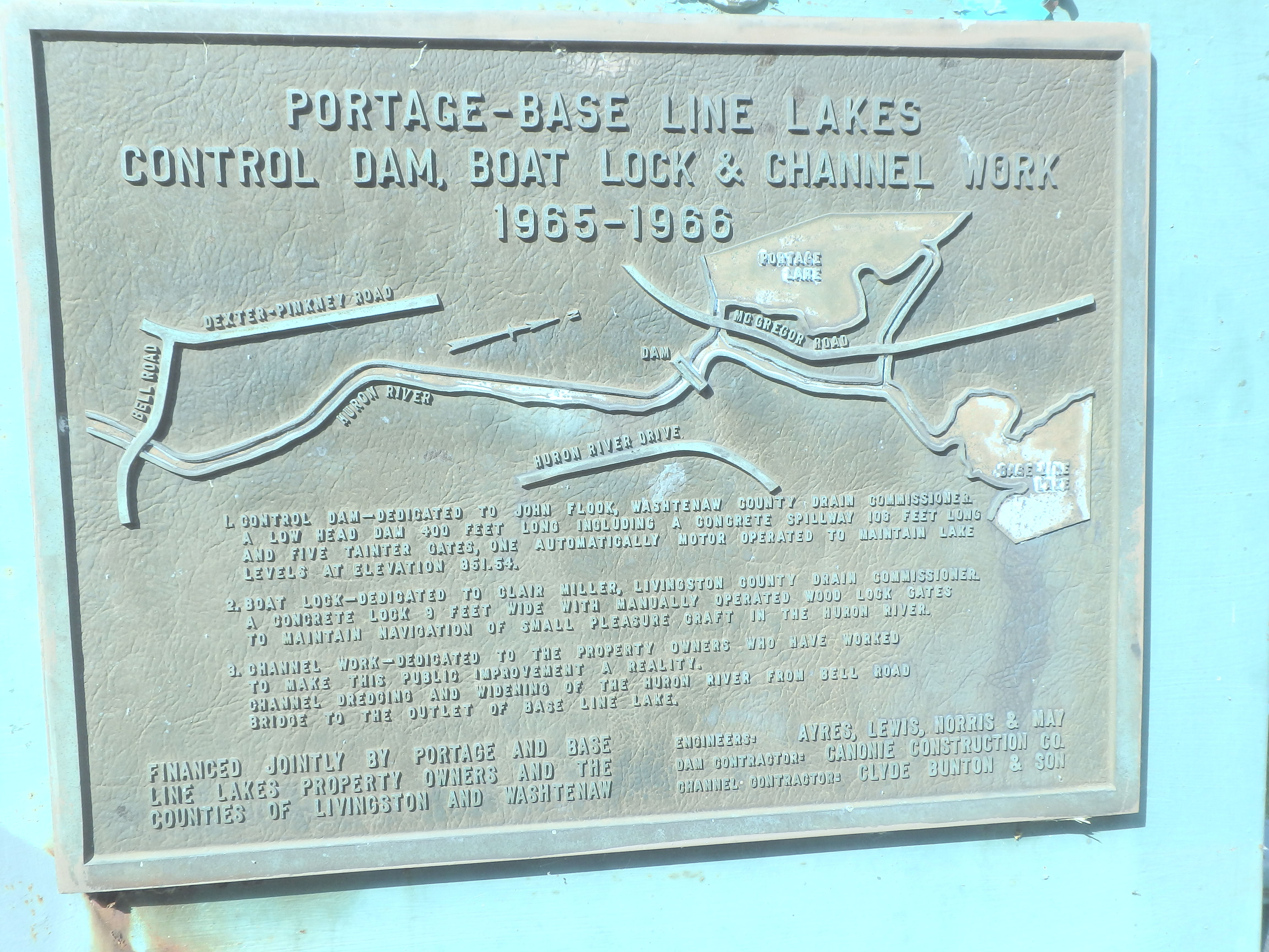
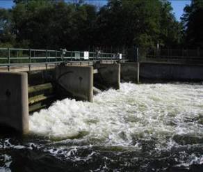
The John Flook Dam and Clare Miller Boat Lock
A Court order setting the Portage Lake Level of 851.54 feet above mean sea level was issued in February of 1949 in Circuit Court of Washtenaw County by Judge James Breakey and was recorded in September of 1949. The original lake association, which was called the Big and Little Portage Lakes Association, wanted to do something about the severe flooding that occurred in 1946. The Association petitioned the court to set the level at 851.54. The Association was represented by its President Marshall Guido who was also an attorney. Property owners from Portage Lake were also there and testified that the normal desired level of Portage Lake was this 851.54 feet above sea level. Tom noted that Judge Breakey said in his ruling that this level would be normally maintained at this level. The term "normally" was somewhat vague but was intented to indicate the permitted differential which was not specified. This same process followed for Base Lake several years later.
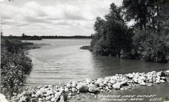
Nothing was done by Washtenaw County to implement the court order so the Portage Lake sailboat racers built a stone dam across the river behind the Trading Post and also at the Portage Launch Site Bridge to try to at least control the summer lake levels.
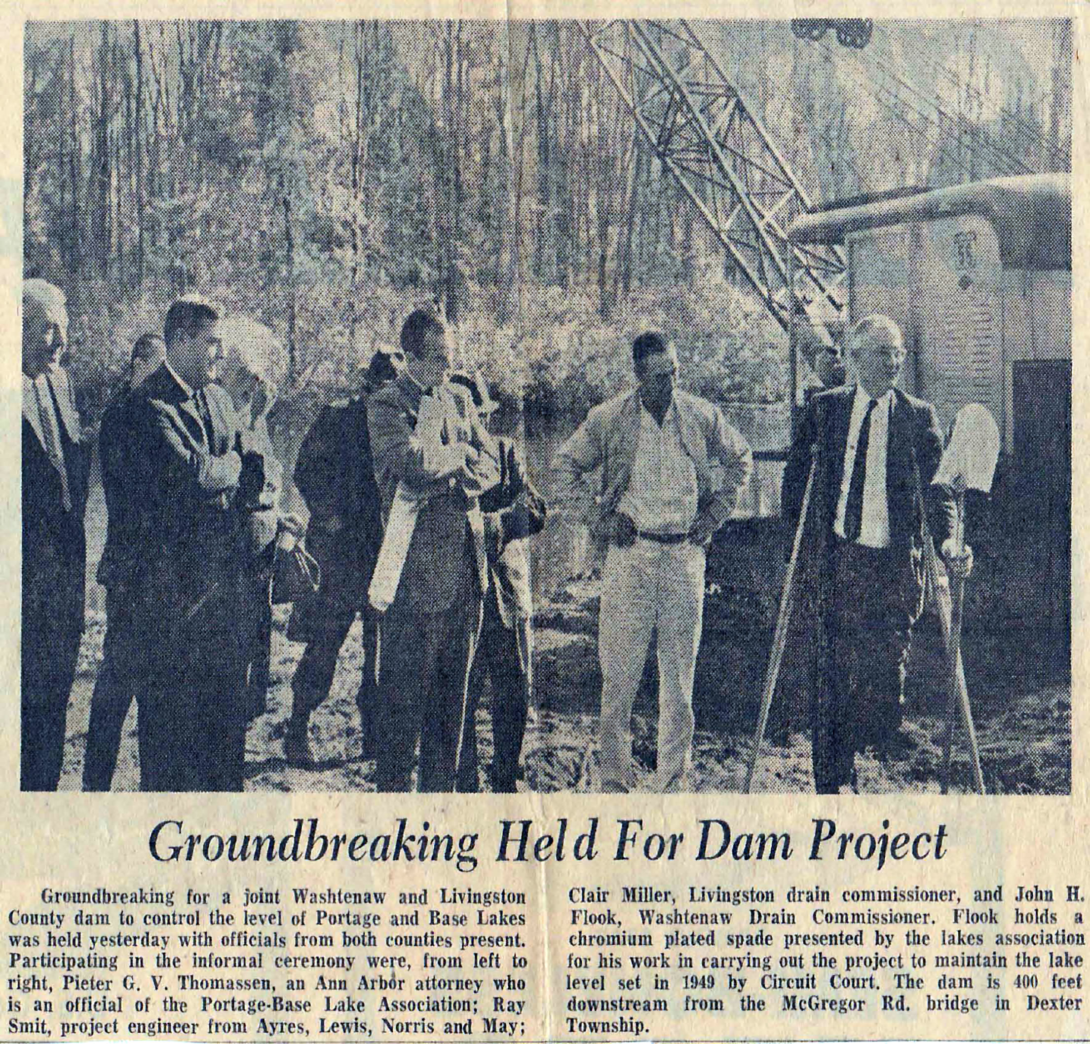
In 1964 Tom Ehman and others submitted petitions signed by owners from Portage and Base Lakes asking the Washtenaw County Board of Supervisors to put a Dam in to control the flooding and to maintain the lake level at 851.54. A member on the Washtenaw County Board of Supervisors and Chair of the Ways & Means Committee was Don Silkworth who had a home on Portage Lake that had previously been flooded. Fortunately, he was really supportive of the project if there was no cost to the county. As it turned out, when Tom was prepared to present a box of petitions to the county, they didn’t even look at them. Tom said that the County Commissioners told the Drain Commissioner, Mr. John Flook to get going on getting the SAD together. But he dragged his feet and nothing was getting done.
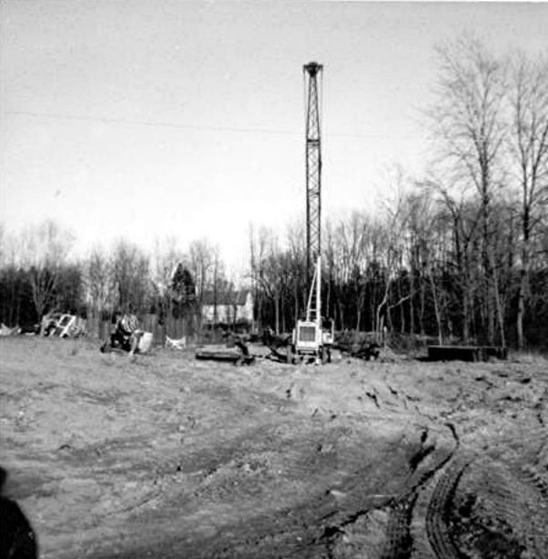
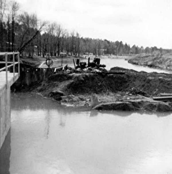
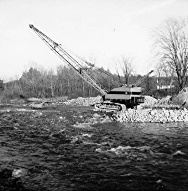
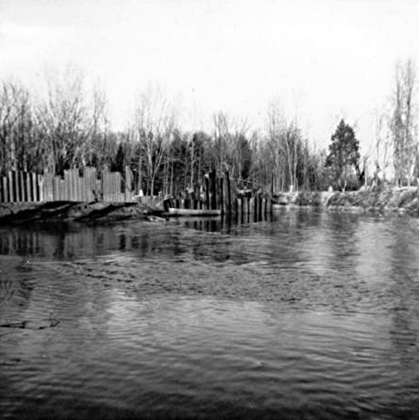
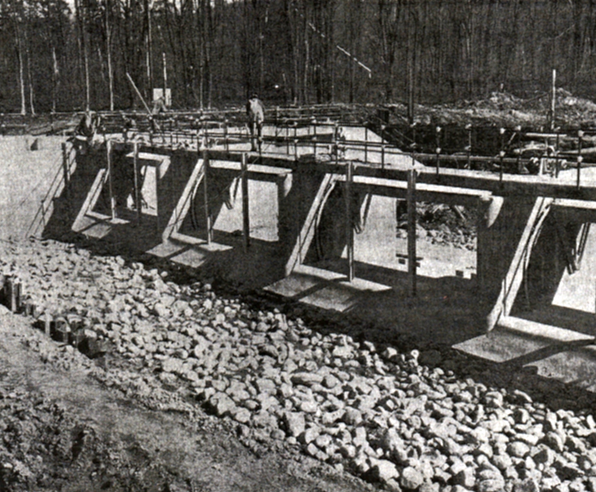
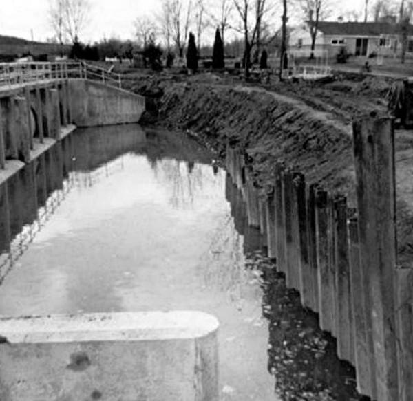
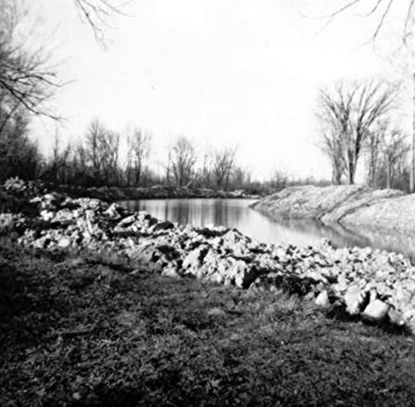
Tom and another association member Pieter Thommasen went into the county and township records and established the level of the highest water mark of the 1946 and 1957 floods that was determined to be 855 feet above sea level. Anyone with property in this floodplain level would be included in the Special Assessment District because it would be a benefit to the owners. There were no complaints about the 855 level or who was included in the SAD. The dam was constructed in 1966. Photos of the construction project are shown below. As part of this project, the river was also dredged from Base Lake to Bell Road to reduce the risk of flooding due to flow restrictions in that part of the river.
Tom went on to say that in 1967 we had a January Thaw. Ice had built up so thick on the dam gates mechanism that they couldn’t remove it with a sledge hammer and torches. The Association was afraid that they were going to get sued for the water damages to the cottages around the lake. The thaw didn’t result in flooding of homes but it did knock out drainfields. The results of this debacle was that they learned that the only way to control the water level in the winter was to first lower the water levels in Portage and Base and then use the stop log method of controlling the water.
The SAD is still in effect today. The State Statute said and still says the County Board of Supervisors (now the Commissioners) can designate, at their pleasure, which County manages the SAD and operates the Dam. At the time the dam was built they choose Washtenaw County Drain Commissioner. The SAD is managed by Washtenaw and Livingston Counties as far as collecting the taxes that went to pay off the costs of building the dam and then collect assessments every year to pay for the cost of maintaining and operation of the Dam. There is no money being pooled for major repairs or replacement of the Dam and most likely there won’t be. Washtenaw is administering the operation and maintenance. The taxing authority runs as long as the dam is there. Tom said that the property owners listed in the SAD own an undivided interest in the John Flook/Portage Dam.
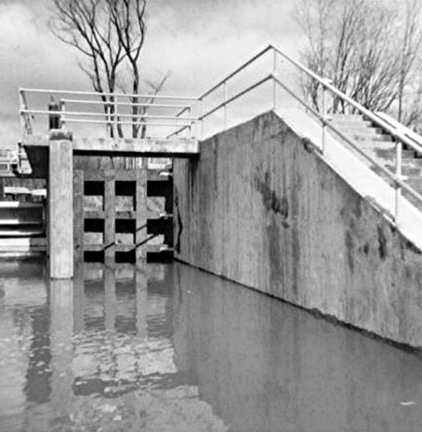
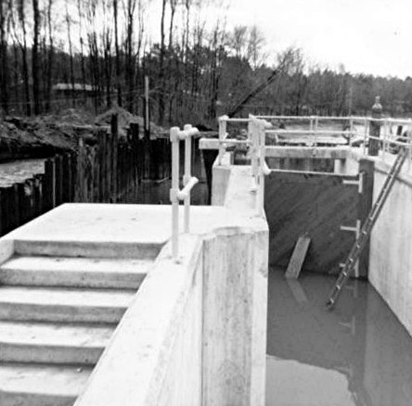
Costs: Tom said that his recollection is that it was about $250,000 for the Dam with $75,000 in a contingency fund which was used to drill new water wells for the owners downstream on the river who lost their wells because of the lowering of the water table. Also the lower river people where threatening to get an injunction to stop the dam construction because they would be cut off from using the river upstream so quickly a boat lock was designed and incorporated into the project which used up the $75,000. The people still filed legal action and the court ruled that this boat lock was a fair solution for what they really could previously use during real high water. The Boat Lock worked all right but it was very high maintenance because of debris being thrown into it. The Lock was eventually filled in, but remnants can still be seen on the far side of the dam.
Question: Who was John Flook? He was the Drain Commissioner for Washtenaw County. The Boat Lock was named after Clair Miller the Drain Commissioner for Livingston County.
Operation of the Dam
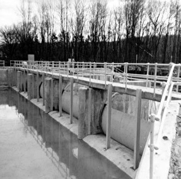
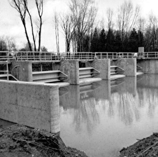
The dam contains five “Clam Shell” gates which raise and lower in a curved channel. These gates can be opened or closed by the dam operator (who conveniently lives adjacent to the dam) to regulate the flow of water through the dam. The gates are lifted to open them allowing water to flow under the gates. When the gates are all closed, water will continue to flow over the tops of the gates once the upstream level is at least 851.54 feet. When there is increased flow upriver, one or more of the gates are opened to maintain the lake level.
Winter Operation: There are many benefits to being able to lower the water level by 15-18 inches during winter. In addition to preventing ice damage to sea walls and other waterside structures, it also provides a huge reservoir that can absorb springtime flood waters. From an ecological point of view, it is good for the natural function of the river to be down in winter months as it was before the dam was built. The current method of regulating the winter level is to put three of the gates in full open position after placing stop logs in vertical channels in front of the gates. The remaining two gates are used for dumping water downstream when there is a need. The tops of the stop logs are set to maintain wintertime level 15-18 inches below 851.54.
Construction Photos
Click on pictures for a larger image.